Environment & Climate
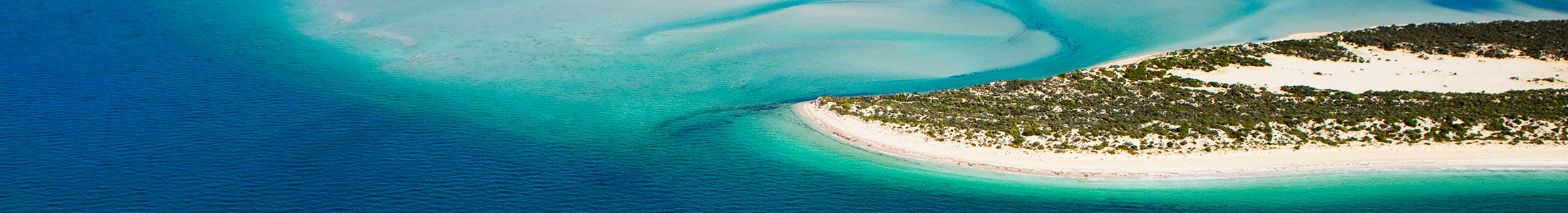
Eyre Peninsula has a coastal and rural environment with approximately one third of South Australia’s coastline stretching over 2,000 kilometres from the upper Spencer Gulf to the Western Australian border. The region is renowned for its coastal and marine environment, with its rugged and largely undeveloped coastline making up almost one half of South Australia’s coasts. The coastal and marine environment includes both marine and conservation parks and encompasses approximately 250 islands ranging in size from about 180 to 40,000 square metres.
The region has a Mediterranean climate with warm to dry summers and cool, wet winters. Average maximum temperatures range from 25-29°C near the coast to 34°C inland. During winter, the average maximum temperatures range from 15°C to 18°C. The region is cooler than Adelaide in summer, and a degree or two warmer in winter. This climate is ideal for a relaxed outdoor lifestyle, which is a characteristic of the regional culture.
Mean annual rainfall varies from 250mm in the north and northwest to more than 500mm in the south.
The geographical relief is undulating and low, with most areas less than 150 metres above sea level. The largest hills are located in the Gawler Ranges north of Wudinna with granite peaks reaching 500 metres. The Koppio Hills form a spine down the central part of the lower Eyre Peninsula and are the most prominent topographical feature in the southern part of the region.
The north west incorporates the Maralinga Tjarutja Aboriginal Lands and part of the Great Victoria Desert, and abuts the Western Australian border about 300 kilometres north of the Trans Australian Railway Line. This area includes the ochre and red sand ridges of the Ooldea Range which are partially covered in spinifex, sheoaks, mallee and desert oaks. The far western area between the Great Australian Bight and Trans Australian Railway Line includes the eastern fringe of the Nullarbor Plain which stretches into Western Australia.
A large proportion of land has been cleared for agricultural production; however, substantial areas of native vegetation remain. Vegetation clearance for agricultural purposes ranges from 14% in the far west to 72% in the south. About 15% of the region’s grazing area is covered with scattered vegetation.
Approximately 7.5 million hectares of land is contained in about 100 national parks, conservation parks and reserves. The Lincoln National Park and Coffin Bay National Park at the bottom of the Eyre Peninsula are significant tourism attractions. Other key parks and reserves include:
- Gawler Ranges National Park
- Great Australian Bight Marine Park
- Lake Giles Conservational Park
- Lake Newland Conservational Park
- Mamungari Conservation Park
- Nullarbor National Park and Regional Reserve
- Point Labbatt Conservation Park
- Sir Joseph Banks Group Conservation Park
- Whyalla Conservation Park
- Yellabinna Regional Reserve and Wilderness Protection Area
For more information: