Aboriginal History
Aboriginal people have lived in the region for thousands of years. The predominant cultural groups at the time of European settlement were the Nauo, Barngarla, Wirangu, Mirning, and Kokatha. Tribal boundaries were not rigid due to migratory movements and influence from adjoining peoples.
Anangu Pitjantjatjara Yankunytjatjara people inhabited the Great Victoria Desert. Now generally referred to as Anangu and collectively known as ‘Spinifex People’, they migrated through the Maralinga Lands to Ooldea and the coast following known rock holes routes.
Ooldea was an important trading, meeting and cultural site, largely because of a permanent water supply in Ooldea Soak. Ooldea became prominent for European people in 1917 due to its location next to the Trans Australian Railway Line; the activities of Daisy Bates (who lived at Ooldea with Aboriginal people 1919-36); and the establishment of the United Aborigines Mission (UAM) and School by Annie Lock in 1933.
Ooldea Mission closed in 1952 and the Aboriginal people dispersed across the region. However, most were rounded up by Government rangers and relocated to Koonibba Mission and Yalata Mission. The traditional owners were then told to stay away from the Maralinga Lands, and the British Atomic Test program began at Emu Junction in 1953 and Maralinga in 1955.
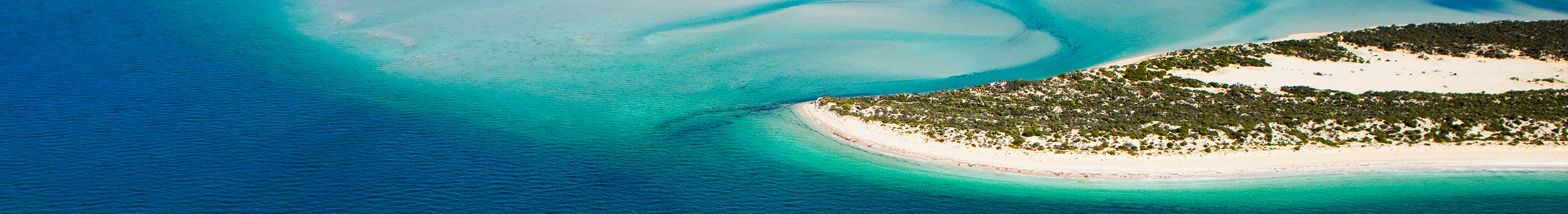
Archaeological surveys across the region have identified many sites of Aboriginal cultural significance which are recorded under the State Heritage Register. However, the region also has many unrecorded sites of major significance to Aboriginal people.
In 2021 the region was home to 3,538 Aboriginal people comprising 6.2% of the regional population, which is notably above the proportions in South Australia (2.2%) and Australia (2.9%). 80% of the Aboriginal population (2,790) live in Whyalla, Port Lincoln and Ceduna. The greatest concentration is in Ceduna, where Aboriginal people comprise 24% of the Council population.
To the west of Ceduna are the Aboriginal communities of Koonibba, Yalata and Oak Valley which have fluctuating populations between 50 and 200 people. Oak Valley was established in 1985 following the Maralinga Tjarutja Land Rights Act, and is the only community on the Maralinga Tjarutja lands.
Yalata Aboriginal Community is located on a tract of land stretching along the coast from the west of Nundroo to the Head of the Bight. The land is owned by the Aboriginal Lands Trust on a perpetual lease to Yalata Aboriginal Community Inc.
During the 1990’s the Aboriginal and Torres Strait Islander Council implemented an Aboriginal Homeland policy which resulted in pockets of land being purchased for the establishment of family based Aboriginal communities. Ten homeland communities are located near Ceduna, and three near Port Lincoln.
In 2012, an Indigenous Tourism Trail was established along the Eyre Peninsula coastline from Poonindie near Port Lincoln to the Head of the Great Australian Bight. This initiative links several sites of Aboriginal heritage significance, and was designed to enhance and develop Aboriginal tourism product.
The Far West Aboriginal Tourism Strategy was released in 2017, and reviewed in 2023 providing support to current and emerging Aboriginal tourism enterprises in the Far West of our region.
European History
The first recorded European contact with the region was near Ceduna in 1627 when a Dutch sailing vessel Captained by Francois Thyssen was separated from a convoy on the way to Djakarta. A Dutch East Indies Company official, Pieter Nuyts, was on board and Thyssen named Nuyts Land, Cape Nuyts and the Nuyts Archipelago after his passenger.
Further European contact did not occur until 1802 when Matthew Flinders mapped the coastline in the HMS Investigator. Flinders named several sites along the coast including Point Bell, Point Brown, Denial Bay, Smoky Bay and Boston Bay, and named the southern part of the region Port Lincoln after his native county of Lincolnshire in England. Flinders then navigated the northern reaches of what he called Spencer Gulf and was followed in January 1803 by the Frenchman Louis-Claude de Freycinet who charted the area for the Nicholas Baudin expedition.
Monuments to Flinders and Freycinet are located in Port Lincoln and Whyalla, and a Freycinet Trail follows the coastline north of Whyalla at Point Lowly. The Baudin expedition named numerous sites along the coast including Murat Bay and Decrees Bay at Ceduna.
French whaling ships fished the bays and islands near Port Lincoln during the 1820’s to 1840’s, and sealers were also operative during this period. The whaling and sealing industry did not last long and collapsed within a few decades from over fishing.
In 1836 Colonel William Light surveyed the Port Lincoln area as the potential capital of South Australia, but it was rejected in favour of Adelaide due to the lack of water supply. Port Lincoln nevertheless became the region’s first European settlement when settlers arrived in three ships on 19th March 1839.
During the 1840’s Edward John Eyre walked across the Eyre Peninsula and was the first person to extensively map the land. In 1840, he reported the presence of iron stone in the Middleback Ranges, 50 kilometres west of Whyalla. Eyre’s exploration led to further settlement. By the 1870’s much of the region was being grazed and the first attempts to mine the Middleback Ranges at Iron Knob occurred in the 1890’s.
The settlement of Hummock Hill – a unique land form named by Matthew Flinders – began in 1901 and had a population of about 50 people. The settlement was the export point for the iron ore mine at Iron Knob. Hummock Hill gradually grew and, on 16th April 1914, it was re-named Whyalla.